From Nairobi We did a 6 day trip to climb Mt Kenya. It is the 2nd highest mountain in Africa so worth a look we thought. Our cousin in Nairobi dropped us off at the pickup point that day we were to start. A driver first drove us the 4 hours up to Nanyuki where the hiking guys met us. Our group consisted of a guide, a cook and three porters plus us two. We only needed therefore to carry our day packs with water, a warm jacket, pants gloves etc in it if we were to need them.
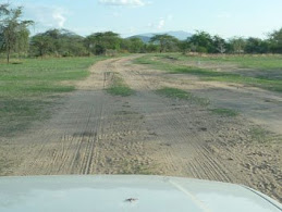
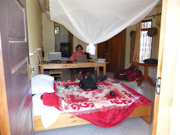
The first day was a 9 km hike from the park gate up to a hut along a 4WD vehicle track. It was up to an altitude of 3000 m (10,800 ft), it was dark when we got there and the temp was falling quite a lot. We had expected to be in little tents, but found out we were in a bunk hut. Being out of the wind made it so much warmer. A bunk bed with a mattress, what a luxury we had. Still it was quite chilly. Hot soup and a big meal from the cook helped. Way more food than we could eat however.
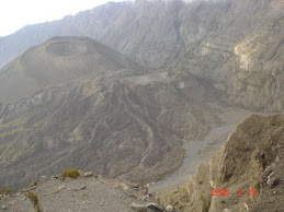
From that hut, the next day’s trail was up a big valley to the peak region. A full day’s hike but beautiful scenery. We were passing these cactus like vegetation. Groundsel and Lobelia, very different to conventional plants. Near the head of the valley we were walking through a forest of these plants, very surreal like something off a Star Trek Episode. Unlike Mt Kilimanjaro which is a huge conical single mountain, Mt Kenya, originally was a much broader mountain and erupted much longer ago than Kilimanjaro so it is more weathered. The original volcano shape has gone, no crater or such, but just these soaring high columns of rock sticking up into the air. The Mountain has multiple peaks clustered into one region which is where the cone must have formerly been. The two highest you can’t trek to as they are almost 1000 m high columns of vertical rock face. The third peak which is where everyone hikes to, can be reached by a rock scramble for the last 100 m. Picture this region as this central region where all the peaks spring up then leading radially away down from that region are these big U shaped carved valleys scouged out by massive glaciers eons ago. In amongst these peaks towers there are still glaciers. A beautiful rugged site.
Ramona’s Birthday was the next and we started to do a hike about ½ way around the peaks in an anticlock wise direction. With the rock peaks to out left and the big U shaped valleys on our right we circuited around ½ of the peak region. At some point we were walking on a path on the side of a cliff, the massive rock face just meters away on the left and the cliff then falling down into the valley on our right. Not so narrow as to be dangerous but very exhilarating to be there is this massive set of structures all standing together.
Getting to the actual trekking summit was the goal of day 4. We hiked a few hours up to a hut at the base of the rock towers. From there one of the glaciers was to the left at the base of the two highest rock towers, the trekking peak called Pt Leanna was high in front of us about 500 m (1/4) mile away. The guide took us off up towards the Leanna peak. It was a bright sunny though rather cool day. The going started off easy then got trickier as we scrambled up rocks to get higher. At some points it was quite narrow with a potential big fall to the left and big rocks on the right. I was right behind Ramona with the left hand out ready to catch her in case she slipped. She was fine though and after 40 mins climbing and hauling ourselves up rocks we got on the top rock little plateau. 4985 m (16,300 ft). Only the two twin rock towers to the west a few 100 m away were higher than us now. The view was for miles and very clear. There were clouds down below us further out. There was a flag pole on top with a rigid flag on it that was half falling down. We spent a 15 mins or so taking pictures and then started back down. Lunch was back at the hut. From there we stated walking down the eastern valley to the camp site for the night. About a 4 hr walk. Along the way was a memorial metal plaque bolted to a cliff face where a plane had crashed a 3 or so years ago in which a South African family of parents and 3 kids & pilot had smacked into the cliff and all perished. That night we did camp in a little 2 man tent and it was freezing all night. Brrrr. It was at a designated camping area around which there were some small lakes called Tarns. But the trash from other campers was quite bad and left a bad impression on us.
The Temple point was the start of Days 5 hike. This was a rock cliff not far from where we had camped. It towered over the Gorges valley we were to follow out that day. The bottom of the valley was vertically way down below us. The Temple point was a shear rock cliff that we were on top of. It was nerve wracking to get near the edge and peer over it. Wow what a drop. While on the cliff edge two helicopters came for a tourist fly around. They flew down the Gorges valley and they were way below us just little things. As we walked out the wild flowers out along the way were striking. So many varieties and colours. Along the way I saw a bunch of strewn shiny things on the ridge on the other side of the Gorges valley about 1 km (1/2 m away) . I asked the guide if that was another wreck? ‘Yep’ he said ‘about 20 yrs ago and no one has gone to clean up the wreckage’. The 6th day was a hike out and a ride back to Nairobi.
A beautiful mountain with spectacular scenery, fauna and geology to awe at.
Saying Goodbye to Tanzania

Farewell Gift from Max at Airport

Farwelling our Little Truck

Goodbye from the Adra Staff
Ugandan Gorilla Encounter
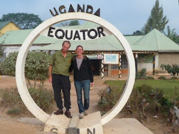
He's in the South, She's in the North

Terraced Hills

Masks

Congo Mask

Ramona in the Impenetrable Forest

Taking a Break from Bush Bashing

The Bush Scramble

Silverback Gorilla

Gorilla Close Up

Canoeing in a Dugout

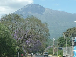
Volcano on Border

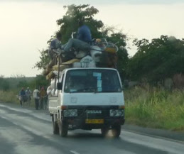
The Ubiquitous Transporter
Treking Mt Kenya

Groundsel Forest at 4200 m

Lobelia Plant

Treking by Arthurs Seat

Midget Peak

Glacier Amongst the Peaks

Trail to Summit

On the Summit Pt Leanna

Ramona on Summit Leanna

The Temple
Nairobi Trip Sights

Out of Africa House
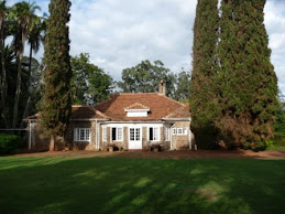
Blixen House from Rear

Dressed up for Etara

Etara Ceremony

Ugandan Men at Etara

Ugandan Ladies at Etara

Feeding Giraffes

Daisy
Leaving Babati

Babati Project Staff Farewell

Darn with Motel Staff

Maji ya Moto - Hot Water
.JPG)
Downtown Maji ya Moto

Volcano in the Making
Mt Hanang Climb

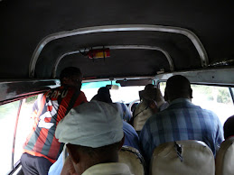
The On Time Bus

Inside Bus

Ramona in a Cave

On a Rock Near Top

On Top of Mt Hanang

Wild Flowers on the Mountain
Visit to Victoria Falls, Zambia

View from Helicopter

Victoria Falls in High Season

Atop the Falls

Zambia-Zimbabwe Bridge

Batoka Gorge below Falls

Zambezi Sunset at Top of Falls

Dr Livingstone I Presume?
.JPG)
Abseiling Batoka Gorge

Ramona Launch on Flying Fox

Ramona on Flying Fox
.JPG)
The Gorge Swing
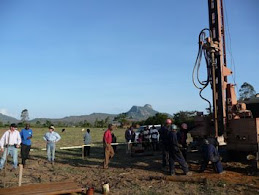
Drilling in Babati

Laying out Survey Cables

Survey in Maize

Replacing Rig clutch on Roadside

Chuck Panning for Gold in Cuttings

Water Erupting from Bore

Standing too Close to Rig

Measuring Flow Rate with Weir

Measuring Flow Rate in Bucket

Stuck in Sangara

Digging out the rig in Lotto

Flooding in Babati Street

Kids Fishing in Drain
Loss of a Sister, Elinor

Elinor on Right, 2-Mar-10
Pangani

Relic from Better Days

Dhow in Pangani River

Lodge Buffet

Beach Craft

Ramona & Giant Clam

My James Bond Impression
Serengeti Park is Amazing

Park Entrance

Serengeti Hot Air Ballooning

Landcruisers in Mud

Beautiful Cheetah

Landcruiser Frenzy

Leopard Resting in Tree

Lions Hanging Out

Santa is Here!

The Hippo Pool

Angry Buffalo

Serengeti Giants
Oldavai Gorge

R2 on Oldavai Gorge Edge

3.6 m year Old Foot Prints

Oldavai Stone Tools
Boots Our Dear Friend
Our Little Boy Boots

Boots and Kimba
Lake Eyasi - A Cultural Trip

Karatu Campground

Eyasi Sunset

Clifftop Lookout

Poison Rock

Shadow of Hadzabe on Landy

Hadzabe on Landy

Hadzabe Bows

Hadzabe House

Ramona Grinding Maize

Datoga Forge

Datoga Bracelets
Natron; A Place of Wonders

Engaruka Stone Ruins

Lake Natron Dry Shore

Chatting with a Local

Fixing Broken Suspenson

Opps, Jack fell over!

Local Taxi

Night Climbing

Pool Relief

Synchronised Swimming

Natron Flamingos for Ever

Natron Flamingos

Maasai Woman

Mountain from Village

On the Crater Rim

Ol Doinyo Lengai Shadow

Inside Crater

Wary Osterich
Lions in Ruaha Park

Bedroom at Ruaha Lodge

Jumping Baboons

Large Baobab Tree

Resting

Eyeing an Impala

Cheetah Cubs

Isimila Columns

Isimila Site

Driving Challenges in Tz

Roadside Fires
VSA Rep On a Tour

Musa trying a Pump
Pumps are Installed

Gairo Buckets Lined Up

Nick First Pumping

No Water is Wasted

Buckets Ready

Installing Pump Head

Installing Rods

2 Pump Sites

Pulling Rods

Pulling Rods

Last Night in Gairo

Gairo gifts
On No

Dislocation #2
More Puppy Pics

Playing with Puppies

Puppy Cage
Tanzania Road Sites
It's full!

No Bus is Ever Full in Tanzania

Roadside Vendors Sell their Wares

End of Maize Season

Maize Sellers

Rain Water Harvesting in Gairo

New Water Well in Gairo

Cute Puppies
Filling in while waiting on the Pumps

Assembled Incubators

Assembling Incubators

Mt Meru from our Cottage

Hiking on Mt Meru

1/2 Way to Christmas Party

1/2 Way to Christmas Dinner

Present Time

Watching the All Blacks

Ngorogoro Pavalova
On Hold in Arusha

Tz road adventures

Ramona boarding the plane

Matt and Lauren

Pancake night

Kimba, the fluffy one

Boots, content

Night kit
Installing hand pumps

The first water pumped

Ramona giving instructions

3 kid friends operating pump

Tools made

Buckets under the new pump

Installing pump head

Installing 4m extensions

Laying out extensions
Mikumi Wildlife Park

Eyeing the car

Giraffe wandering across road

Water Buffalo in mud

Hippo

Zebras are many
Buckets and Buckets of Water

Filling Buckets


Pump out of Bore

Pump Test Set up on Site

Tub of water
Quintessential Rural Tanzania

Picture describes it all
Drilling Phase

We have water!

Driller up mast

This is Tanzania

Kids playing with Ross at site

Spectators and friends

Govt officials visiting site

No wild game left, only cows

Finished Pump Slab

Making a pump slab

Water from a pump test

Women carrying water from pump test

Rocky outcrop
Gifts for Drillers

Jerimah with saftey items on

Driller with dust protection on
Scene from National Geographic

Crowd Watching at Luhwaji

Discusing Prayers

Elders gathering at wellhead

More Crowd
Life of a Tanzanian Driller

Ramona digging out sand

Making a runway

More logs needed

Stuck close to house

In the sand again

Rig truck towing support truck

Support truck stuck in river bed

Placing logs under wheels

Stuck in riverbed sand

Sandy river crossing
Can of Sprite

Guy with Sprite Can after work

Worker going down well

Worker down well

Opening the well

Open water pit
Deforestation

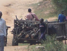
Bicycle loads of Charco wood

Bicycle load of bags of charco wood

Bicycle load of wood

Trees cut down

Branches being gathered

Tree just cut down

Woman carrying log
Front view
Gairo house
View out front door

Gairo house
Ramona at work

Gairo house
Saving Water

Gairo House
Scooping up overflowed water

Gairo House
QED pump kit

Gairo House
Fishing boat

Dar es Salaam
Boarding Dhow to Kilwa Kisiwani

Kilwa beach
Dhow on way to Kilwa Kisiwani

Kilwa
Ruins Palace main hall

Kilwa kisiwani
Ruins courtyard steps & decorative wall

Kilwa Kisiwani
Ruins wall

Kilwa Kisiwani
R2 at Ruins

Kilwa Kisiwani. Kilwa in background
Water pump instructing

Kilwa Kisiwani
Ruins archway

Kilwa Kisiwani
Ruins tomb stone

Kilwa Kisiwani
Ruins grave site

Kilwa Kisiwani
Ruins older Mosque

Kilwa Kisiwani
Ruins Mosque

Kilwa Kisiwani
Ruins wall insert

Kilwa Kisiwani
Ruins

Kilwa Kisiwani
Fishing boat on beach

Kilwa
Shark for dinner

Kilwa Beach
Dhow setting out

Mtwara
Church Nativity scene

Mtwara
Church Painting

Mtwara
Dhow coming home

Kilwa
Bar of Lodge

Jimbiza Lodge Selous
Butterflies - many in park

Selous Game Reserve
Another safari vehicle

Selous Game Reserve
Vulture

Selous Game Reserve
Zebras

Selous Game Park
Elephant family

Selous Game Reserve
High Tea on Safari

Selous Game Reserve
Hippo checking us out

Selous Game Reserve
Wildebeest

Selous Game Reserve
Young Lions out of the Sun

Selous Game Reserve
Giraffes

Selous Game Reserve
Selous Lodge

Ramona at our Room
Road to Kilwa

Oh Oh!
Road to Kilwa

Road jam in the mud
Road to Kilwa

Moving again
Road to Selous

The first puddle
Getting Petrol

Handcranking the pump
QED Hammerhead Pro

Pneumatic Pump
TPS Meter

Salinity and pH Meter
Dirt Street
Road outside Gairo Office
Laying house water line

Drain between houses
Ukwamani 5
Rig Setup
Ukwamani 5

Rig exclusion zone

Women collecting surface water
Wood Gathering
A continual process
Trip to Babati
Dirt Road thru Scrub

Percussion Drill Rig

Bailing Contents from Well
Drillers Quarters on Site

Mosquito net covered Bed

Driving on the local roads
Woman at Spring

Ready to carry water home

Child at a Local Dispensary

Dipping the Old Disused Well

Old Well Head Consultations

An Existing Working Water Well

A new concrete slab near completion

The road after rain
Water Stand

Completed Stand

Water Tank Stand Original

Raising Water Tank Stand

Raising Water Tank
Hardware Store

Hardware Store Exit
Hardware Store

Hardware Store Inside
Hardware Store

Hardware Store Outside

Patty again

Patty

Example Handpump

Working on a water tank

Internet USB Modem

ADRA Entrance

ADRA Admin Offices
Roundel

Roundel
Roundel Inside
Looking in through the roundel door

Work station inside Roundel

Furniture Chest
Mt Meru
Mt Meru with Jacaranda in foreground
Mt Meru Inside
Looking Inside Mt Meru at secondary cinder cone
Hotel
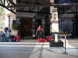
Ramona at Johannesburg Hotel
Nairobi Airport
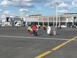
Walking from the Plane in Nairobi
Kilimanjaro plane
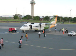
Plane to Kilimanjaro Airport
Ramona with Musa
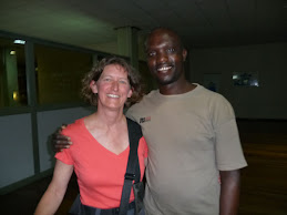
Ramona with Musa of VSA TZ
Ramona at House
The first temp house we stayed in
DalaDala Inside
Inside a DalaDala minivan
Arusha Road

Dirt road in Arusha
Shoprite store

Ramona at check out counter
Supermarket
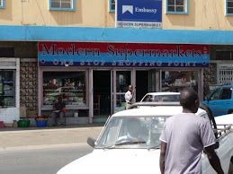
Typical supermarket
Heron Dipper T

Water Level Meter
Heron Dipperlog

Groundwater Data Logger


No comments:
Post a Comment