Well, these are our last words
For those who have not heard
We came to spend two year
Now our time to leave is quite near
Our times have been glad
So departing is sad
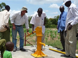
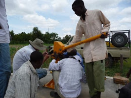
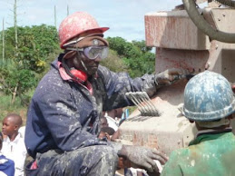
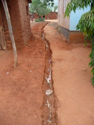
We did a lot of drilling
Which was altogether quite thrilling
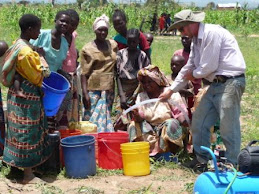
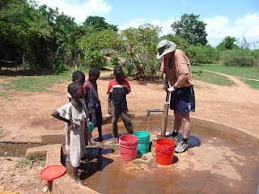
We found plenty of good water
Then made pump slabs from mortar
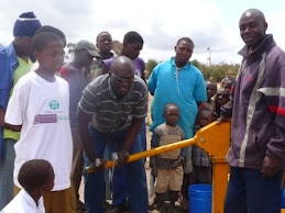
The pumps we did set
And water; the villagers did get
We did some computer training
While the weather was still raining
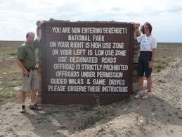
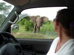
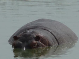
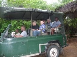
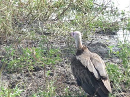
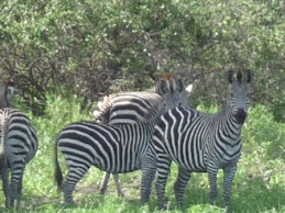
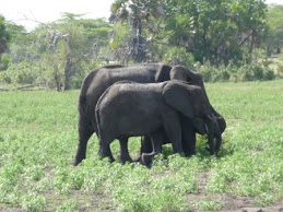
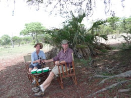
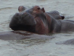
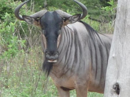
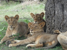
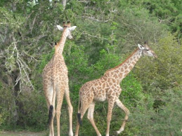
We drove through game parks
To see animals saved on the Ark
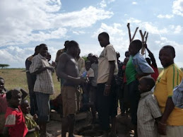
Now we have donated some clothes
To the more needy of those
And it is time to go home
From thither; we will else roam
Wednesday, August 4, 2010
Saturday, July 17, 2010
Gorillas in the Mist
It was like being in Jurassic park. I heard a soft but loud Ummmph sound and then another. There was a rustling in the bushes in front of me but nothing could be seen. Then more grunts and further leaf shaking but still nothing to see. Wow this is awesome. We kept walking forwards.
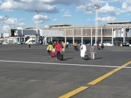
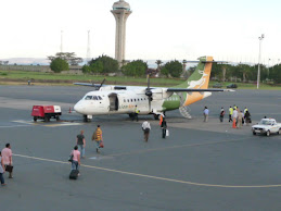
While on our Kenya trip we caught a plane over to Entebbe in Uganda and met up with a tour operator who took us on a trip across Uganda down to the south west corner to a little town called Kisoro just a few km from the Rwanda and Congo borders. This is where the thick jungles are and the home of the large mountain gorillas. This is also the region where Dian Fossey spent a lot of her research time with the gorillas and Kisoro was the town she stayed in when not in the bush.
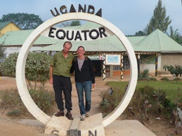
The drive from Entebbe to Kisoro is about 10 hour drive, it is a long haul. And this is driving at crazy speeds not the normal speeds we drive at. I had to ask the drive to slow down several times as I thought getting a little child run over was imminent or passing on blind corners was an unnecessary risk. He was a good driver though so not too many grey hairs were added. Along the drive we crossed the equator which made a good photo opportunity. Uganda is very green compared to Tanzania. Especially in the SW there were farms carved out in terraces on all the hills. The terraces make little flat areas to put crops on. The driver said ‘this was the African Alps without the snow’. It is quite hilly but they are all covered with this patch work of terraces and their various coloured crops, which made a very pretty back drop. Like a big patch work quilts thrown over the hills.
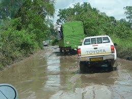
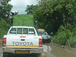
The road was poor but it was being worked on in various places by road crews . Hence once again, next year it will be a nice drive. It is great what progress happens in election years. The driver said it was the last of the main roads to seal in Uganda.
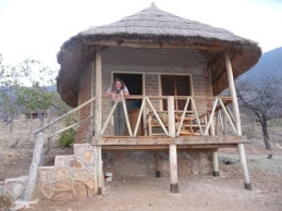
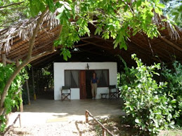
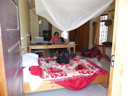
The lodge we were put in was called The Travellers Rest, run by a Dutch couple and considering where we were it was very nice indeed. There was a lot of Congolese art work and masks around, the place some quite detailed and ornate giving it this out of the ordinary appearance. Ramona finds the masks spooky.
The next morning was an early start as it was a 40 km (25 m) drive up in the mountains on a bad road to get to the park headquarters. That took about 1-1/2 hours. The Bwindi Impenetrable Forest takes 8 people per day to see a specific group of Gorillas. The idea is to hike into the jungle to find them, then once there sit with them for an hour then hike back out again. So we joined 6 other people, 2 Aussies, 2 Italians, and 2 Dutchies. After a brief talk on the day by the head guide, they gave us long walking sticks which soon became very evident why, then we headed off up into the bush.
This is no ordinary bush walk. This is the country legends are made of. It is quite steep, dense bush in most places, lots of undergrowth and tall trees. Thankfully it was dry and not wet and slippery. Earlier in the day the park sends off trackers to the last spot the gorillas were sighted at the previous day, then they start tracking them to see where they went to overnight. Once on the gorillas trail they radio back to the guide leading us and give directions of where to do. Sounds simple but doesn’t always work. The radios don’t work down in deep gullies so we have to climb to ridges to get reception. This would take an hour or so. Then the trackers have to try to describe where they are in this dense bush to the guide. All the gullies and ridges looked the same to me. The hills are so steep that is why the long sticks are needed to push in downhill before you step down using the stock as an anchor. We hiked along for about 5 hours, down in gullies, in little streams, crawling under fallen trees and vines at times. At about 3 pm it was clear that if we were to get out by dark we’d have to turn back soon. I had the impression we had not been hiking in a straight line for 5 hours, so it shouldn’t take us 5 hours to get back hopefully.
All of a sudden the guide up front said ‘stop’, the trackers were close and the gorillas were not far away coming towards us. We slipped off our packs dug out the cameras. Leaving the packs there, we started moving forward through the trees and ferns. It was like being in Jurassic park. I heard a soft but loud Ummmph sound and then another. There was a rustling in the bushes in front of me but nothing could be seen. Then more grunts and further leaf shaking but still nothing to see. Wow this is awesome. Then coming into a little low canopy covered clearing we could see the gorillas, some sitting, some on the move on the other side of the clearing. (They were oblivious to us from the 100s of previous visits to their group by other human trekkers. It takes years of visits by guides and rangers to habitualise a group of gorillas to the presence of humans.) The group we came across had about 20 or so in it. We could not see them all at any one time due to the bush. There were a couple of big silverbacks (older males that get silver hair down their backs). They are huge. Shoulders are very broad compared to a man, with a huge head on them. Wide hips too. They walk on two legs and lean on their front arms. The group had mothers, young ones and a few babies clinging to their mothers. One big silverback stopped right down in front of us just a few meters (yards) away and bent down like do a push up to put his mouth in the stream to take a drink, just like a human would. Weird and an eerie feeling to see human like behaviour from this big animal. One of the silverbacks came and sat about 4 m (yd) from me and just put his back to me. I noticed another had done a similar thing. I guessed they did that to show us they knew we were there but they didn’t care and were ignoring us. The juveniles were playing chase with each other swinging on low branches, jumping on each other. We took a lot of photos and videos. (Many of which didn’t come out unfortunately as the camera would focus instead on the braches between us and not on the gorillas. The camera experts did get some good shots however I believe.) After about 40 mins the big silverback leader sort of ordered the group to move on and the disappeared off into the bush. By now it was after 4pm. The guide said if we didn’t mind we should head back so as not to get caught in the bush in the dark. Sounded like a good idea to all of us so off we went. The first thing was to climb out of this deep gully up a steep climb for about an hour to get on top of the ridge. Ramona said if we have to do that 3 more times, we’d be very late getting out. I guessed though that once on top of a ridge the guides would stay on top and we’d walk out a lot easier than when we’d come in. Which turned out to be the case and we got back to the car a 7 pm just after dark. Then it was a 2 hr drive in the dark back to the Travellers Rest lodge. Needless to say we were trashed and tired. They had kept a late hot meal for us which was very well received.
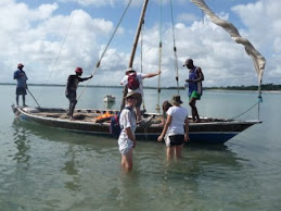
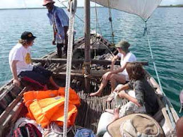
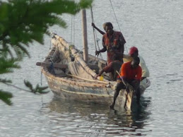
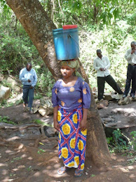
The next day we sort of rested. We took a local guide out to a nearby lake on the Uganda-Congo border and found this guy with a canoe made from a single dug out tree. It was, in local terms a freight canoe, as it was quite long, about 8 m (25 ft). He paddled us around the lake shore a bit then we walked back through some local farms back to the start point. The guide was explaining the different crops to us. Later in the day we talked with the hotel manager about his time in Uganda and goings on in the Congo. We walked around the little town a bit to see what was there which apart for dust from road construction, wasn’t much. The 4th day was the 10 hour drive back to Entebbe.
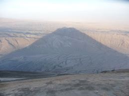
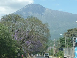
The area around that part of Africa is called Volcanoes park as there are a string of large volcanoes on the Uganda, Rwanda and Congo border just a few km away. Beautiful symmetric mountains rising up to dominate the southern skyline. One has the triple international border on the very top of it. Guides will take climbers up there, but we needed another day had we have wanted to do that
While on our Kenya trip we caught a plane over to Entebbe in Uganda and met up with a tour operator who took us on a trip across Uganda down to the south west corner to a little town called Kisoro just a few km from the Rwanda and Congo borders. This is where the thick jungles are and the home of the large mountain gorillas. This is also the region where Dian Fossey spent a lot of her research time with the gorillas and Kisoro was the town she stayed in when not in the bush.
The drive from Entebbe to Kisoro is about 10 hour drive, it is a long haul. And this is driving at crazy speeds not the normal speeds we drive at. I had to ask the drive to slow down several times as I thought getting a little child run over was imminent or passing on blind corners was an unnecessary risk. He was a good driver though so not too many grey hairs were added. Along the drive we crossed the equator which made a good photo opportunity. Uganda is very green compared to Tanzania. Especially in the SW there were farms carved out in terraces on all the hills. The terraces make little flat areas to put crops on. The driver said ‘this was the African Alps without the snow’. It is quite hilly but they are all covered with this patch work of terraces and their various coloured crops, which made a very pretty back drop. Like a big patch work quilts thrown over the hills.
The road was poor but it was being worked on in various places by road crews . Hence once again, next year it will be a nice drive. It is great what progress happens in election years. The driver said it was the last of the main roads to seal in Uganda.
The lodge we were put in was called The Travellers Rest, run by a Dutch couple and considering where we were it was very nice indeed. There was a lot of Congolese art work and masks around, the place some quite detailed and ornate giving it this out of the ordinary appearance. Ramona finds the masks spooky.
The next morning was an early start as it was a 40 km (25 m) drive up in the mountains on a bad road to get to the park headquarters. That took about 1-1/2 hours. The Bwindi Impenetrable Forest takes 8 people per day to see a specific group of Gorillas. The idea is to hike into the jungle to find them, then once there sit with them for an hour then hike back out again. So we joined 6 other people, 2 Aussies, 2 Italians, and 2 Dutchies. After a brief talk on the day by the head guide, they gave us long walking sticks which soon became very evident why, then we headed off up into the bush.
This is no ordinary bush walk. This is the country legends are made of. It is quite steep, dense bush in most places, lots of undergrowth and tall trees. Thankfully it was dry and not wet and slippery. Earlier in the day the park sends off trackers to the last spot the gorillas were sighted at the previous day, then they start tracking them to see where they went to overnight. Once on the gorillas trail they radio back to the guide leading us and give directions of where to do. Sounds simple but doesn’t always work. The radios don’t work down in deep gullies so we have to climb to ridges to get reception. This would take an hour or so. Then the trackers have to try to describe where they are in this dense bush to the guide. All the gullies and ridges looked the same to me. The hills are so steep that is why the long sticks are needed to push in downhill before you step down using the stock as an anchor. We hiked along for about 5 hours, down in gullies, in little streams, crawling under fallen trees and vines at times. At about 3 pm it was clear that if we were to get out by dark we’d have to turn back soon. I had the impression we had not been hiking in a straight line for 5 hours, so it shouldn’t take us 5 hours to get back hopefully.
All of a sudden the guide up front said ‘stop’, the trackers were close and the gorillas were not far away coming towards us. We slipped off our packs dug out the cameras. Leaving the packs there, we started moving forward through the trees and ferns. It was like being in Jurassic park. I heard a soft but loud Ummmph sound and then another. There was a rustling in the bushes in front of me but nothing could be seen. Then more grunts and further leaf shaking but still nothing to see. Wow this is awesome. Then coming into a little low canopy covered clearing we could see the gorillas, some sitting, some on the move on the other side of the clearing. (They were oblivious to us from the 100s of previous visits to their group by other human trekkers. It takes years of visits by guides and rangers to habitualise a group of gorillas to the presence of humans.) The group we came across had about 20 or so in it. We could not see them all at any one time due to the bush. There were a couple of big silverbacks (older males that get silver hair down their backs). They are huge. Shoulders are very broad compared to a man, with a huge head on them. Wide hips too. They walk on two legs and lean on their front arms. The group had mothers, young ones and a few babies clinging to their mothers. One big silverback stopped right down in front of us just a few meters (yards) away and bent down like do a push up to put his mouth in the stream to take a drink, just like a human would. Weird and an eerie feeling to see human like behaviour from this big animal. One of the silverbacks came and sat about 4 m (yd) from me and just put his back to me. I noticed another had done a similar thing. I guessed they did that to show us they knew we were there but they didn’t care and were ignoring us. The juveniles were playing chase with each other swinging on low branches, jumping on each other. We took a lot of photos and videos. (Many of which didn’t come out unfortunately as the camera would focus instead on the braches between us and not on the gorillas. The camera experts did get some good shots however I believe.) After about 40 mins the big silverback leader sort of ordered the group to move on and the disappeared off into the bush. By now it was after 4pm. The guide said if we didn’t mind we should head back so as not to get caught in the bush in the dark. Sounded like a good idea to all of us so off we went. The first thing was to climb out of this deep gully up a steep climb for about an hour to get on top of the ridge. Ramona said if we have to do that 3 more times, we’d be very late getting out. I guessed though that once on top of a ridge the guides would stay on top and we’d walk out a lot easier than when we’d come in. Which turned out to be the case and we got back to the car a 7 pm just after dark. Then it was a 2 hr drive in the dark back to the Travellers Rest lodge. Needless to say we were trashed and tired. They had kept a late hot meal for us which was very well received.
The next day we sort of rested. We took a local guide out to a nearby lake on the Uganda-Congo border and found this guy with a canoe made from a single dug out tree. It was, in local terms a freight canoe, as it was quite long, about 8 m (25 ft). He paddled us around the lake shore a bit then we walked back through some local farms back to the start point. The guide was explaining the different crops to us. Later in the day we talked with the hotel manager about his time in Uganda and goings on in the Congo. We walked around the little town a bit to see what was there which apart for dust from road construction, wasn’t much. The 4th day was the 10 hour drive back to Entebbe.
The area around that part of Africa is called Volcanoes park as there are a string of large volcanoes on the Uganda, Rwanda and Congo border just a few km away. Beautiful symmetric mountains rising up to dominate the southern skyline. One has the triple international border on the very top of it. Guides will take climbers up there, but we needed another day had we have wanted to do that
Sunday, July 11, 2010
Mt Kenya Climb
From Nairobi We did a 6 day trip to climb Mt Kenya. It is the 2nd highest mountain in Africa so worth a look we thought. Our cousin in Nairobi dropped us off at the pickup point that day we were to start. A driver first drove us the 4 hours up to Nanyuki where the hiking guys met us. Our group consisted of a guide, a cook and three porters plus us two. We only needed therefore to carry our day packs with water, a warm jacket, pants gloves etc in it if we were to need them.
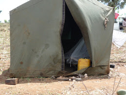
The first day was a 9 km hike from the park gate up to a hut along a 4WD vehicle track. It was up to an altitude of 3000 m (10,800 ft), it was dark when we got there and the temp was falling quite a lot. We had expected to be in little tents, but found out we were in a bunk hut. Being out of the wind made it so much warmer. A bunk bed with a mattress, what a luxury we had. Still it was quite chilly. Hot soup and a big meal from the cook helped. Way more food than we could eat however.
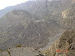
From that hut, the next day’s trail was up a big valley to the peak region. A full day’s hike but beautiful scenery. We were passing these cactus like vegetation. Groundsel and Lobelia, very different to conventional plants. Near the head of the valley we were walking through a forest of these plants, very surreal like something off a Star Trek Episode. Unlike Mt Kilimanjaro which is a huge conical single mountain, Mt Kenya, originally was a much broader mountain and erupted much longer ago than Kilimanjaro so it is more weathered. The original volcano shape has gone, no crater or such, but just these soaring high columns of rock sticking up into the air. The Mountain has multiple peaks clustered into one region which is where the cone must have formerly been. The two highest you can’t trek to as they are almost 1000 m high columns of vertical rock face. The third peak which is where everyone hikes to, can be reached by a rock scramble for the last 100 m. Picture this region as this central region where all the peaks spring up then leading radially away down from that region are these big U shaped carved valleys scouged out by massive glaciers eons ago. In amongst these peaks towers there are still glaciers. A beautiful rugged site.
Ramona’s Birthday was the next and we started to do a hike about ½ way around the peaks in an anticlock wise direction. With the rock peaks to out left and the big U shaped valleys on our right we circuited around ½ of the peak region. At some point we were walking on a path on the side of a cliff, the massive rock face just meters away on the left and the cliff then falling down into the valley on our right. Not so narrow as to be dangerous but very exhilarating to be there is this massive set of structures all standing together.
Getting to the actual trekking summit was the goal of day 4. We hiked a few hours up to a hut at the base of the rock towers. From there one of the glaciers was to the left at the base of the two highest rock towers, the trekking peak called Pt Leanna was high in front of us about 500 m (1/4) mile away. The guide took us off up towards the Leanna peak. It was a bright sunny though rather cool day. The going started off easy then got trickier as we scrambled up rocks to get higher. At some points it was quite narrow with a potential big fall to the left and big rocks on the right. I was right behind Ramona with the left hand out ready to catch her in case she slipped. She was fine though and after 40 mins climbing and hauling ourselves up rocks we got on the top rock little plateau. 4985 m (16,300 ft). Only the two twin rock towers to the west a few 100 m away were higher than us now. The view was for miles and very clear. There were clouds down below us further out. There was a flag pole on top with a rigid flag on it that was half falling down. We spent a 15 mins or so taking pictures and then started back down. Lunch was back at the hut. From there we stated walking down the eastern valley to the camp site for the night. About a 4 hr walk. Along the way was a memorial metal plaque bolted to a cliff face where a plane had crashed a 3 or so years ago in which a South African family of parents and 3 kids & pilot had smacked into the cliff and all perished. That night we did camp in a little 2 man tent and it was freezing all night. Brrrr. It was at a designated camping area around which there were some small lakes called Tarns. But the trash from other campers was quite bad and left a bad impression on us.
The Temple point was the start of Days 5 hike. This was a rock cliff not far from where we had camped. It towered over the Gorges valley we were to follow out that day. The bottom of the valley was vertically way down below us. The Temple point was a shear rock cliff that we were on top of. It was nerve wracking to get near the edge and peer over it. Wow what a drop. While on the cliff edge two helicopters came for a tourist fly around. They flew down the Gorges valley and they were way below us just little things. As we walked out the wild flowers out along the way were striking. So many varieties and colours. Along the way I saw a bunch of strewn shiny things on the ridge on the other side of the Gorges valley about 1 km (1/2 m away) . I asked the guide if that was another wreck? ‘Yep’ he said ‘about 20 yrs ago and no one has gone to clean up the wreckage’. The 6th day was a hike out and a ride back to Nairobi.
A beautiful mountain with spectacular scenery, fauna and geology to awe at.
The first day was a 9 km hike from the park gate up to a hut along a 4WD vehicle track. It was up to an altitude of 3000 m (10,800 ft), it was dark when we got there and the temp was falling quite a lot. We had expected to be in little tents, but found out we were in a bunk hut. Being out of the wind made it so much warmer. A bunk bed with a mattress, what a luxury we had. Still it was quite chilly. Hot soup and a big meal from the cook helped. Way more food than we could eat however.
From that hut, the next day’s trail was up a big valley to the peak region. A full day’s hike but beautiful scenery. We were passing these cactus like vegetation. Groundsel and Lobelia, very different to conventional plants. Near the head of the valley we were walking through a forest of these plants, very surreal like something off a Star Trek Episode. Unlike Mt Kilimanjaro which is a huge conical single mountain, Mt Kenya, originally was a much broader mountain and erupted much longer ago than Kilimanjaro so it is more weathered. The original volcano shape has gone, no crater or such, but just these soaring high columns of rock sticking up into the air. The Mountain has multiple peaks clustered into one region which is where the cone must have formerly been. The two highest you can’t trek to as they are almost 1000 m high columns of vertical rock face. The third peak which is where everyone hikes to, can be reached by a rock scramble for the last 100 m. Picture this region as this central region where all the peaks spring up then leading radially away down from that region are these big U shaped carved valleys scouged out by massive glaciers eons ago. In amongst these peaks towers there are still glaciers. A beautiful rugged site.
Ramona’s Birthday was the next and we started to do a hike about ½ way around the peaks in an anticlock wise direction. With the rock peaks to out left and the big U shaped valleys on our right we circuited around ½ of the peak region. At some point we were walking on a path on the side of a cliff, the massive rock face just meters away on the left and the cliff then falling down into the valley on our right. Not so narrow as to be dangerous but very exhilarating to be there is this massive set of structures all standing together.
Getting to the actual trekking summit was the goal of day 4. We hiked a few hours up to a hut at the base of the rock towers. From there one of the glaciers was to the left at the base of the two highest rock towers, the trekking peak called Pt Leanna was high in front of us about 500 m (1/4) mile away. The guide took us off up towards the Leanna peak. It was a bright sunny though rather cool day. The going started off easy then got trickier as we scrambled up rocks to get higher. At some points it was quite narrow with a potential big fall to the left and big rocks on the right. I was right behind Ramona with the left hand out ready to catch her in case she slipped. She was fine though and after 40 mins climbing and hauling ourselves up rocks we got on the top rock little plateau. 4985 m (16,300 ft). Only the two twin rock towers to the west a few 100 m away were higher than us now. The view was for miles and very clear. There were clouds down below us further out. There was a flag pole on top with a rigid flag on it that was half falling down. We spent a 15 mins or so taking pictures and then started back down. Lunch was back at the hut. From there we stated walking down the eastern valley to the camp site for the night. About a 4 hr walk. Along the way was a memorial metal plaque bolted to a cliff face where a plane had crashed a 3 or so years ago in which a South African family of parents and 3 kids & pilot had smacked into the cliff and all perished. That night we did camp in a little 2 man tent and it was freezing all night. Brrrr. It was at a designated camping area around which there were some small lakes called Tarns. But the trash from other campers was quite bad and left a bad impression on us.
The Temple point was the start of Days 5 hike. This was a rock cliff not far from where we had camped. It towered over the Gorges valley we were to follow out that day. The bottom of the valley was vertically way down below us. The Temple point was a shear rock cliff that we were on top of. It was nerve wracking to get near the edge and peer over it. Wow what a drop. While on the cliff edge two helicopters came for a tourist fly around. They flew down the Gorges valley and they were way below us just little things. As we walked out the wild flowers out along the way were striking. So many varieties and colours. Along the way I saw a bunch of strewn shiny things on the ridge on the other side of the Gorges valley about 1 km (1/2 m away) . I asked the guide if that was another wreck? ‘Yep’ he said ‘about 20 yrs ago and no one has gone to clean up the wreckage’. The 6th day was a hike out and a ride back to Nairobi.
A beautiful mountain with spectacular scenery, fauna and geology to awe at.
Thursday, July 8, 2010
A Trip to Nairobi in Kenya
Thought we had never contacted him before, we knew we had a cousin from New Zealand, living in Nairobi for many years. We had planned a couple of big adventure trips based out of Kenya so thought it would be a good time to catch up with our cousin at the same time and see what he has been up to.
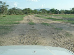
The road from Arusha north to Nairobi is about 300 km (180 miles). The border is little town called Namunga. We drove our Pajero up there and in order to drive a vehicle across an international border there are a few rules to follow otherwise it won’t happen. As you approach Namunga there are no signs to tell you where to go or what to do. Turns out you have to go to Tanzania immigration to fill out a departure card, hand in the original vehicle registration card for the vehicle in another building, then go to Kenya immigration fill out a arrival card and get a visa, then in another building, sign your vehicle into Kenya. Not too bad really but with no signs or officials there, it is confusing. All the while there are merchandise vendors following you trying to sell you Maasai jewellery, international vehicle insurance, vehicle fire extinguishers and more. So anyway we got through after an hour and continued heading on to Nairobi.
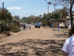
The roads are currently very bad, with diversions in many places, but all along in both countries the roads are being worked on by road construction crews. So some time next year that road all the way from Arusha to Nairobi will be a beautiful sealed road and a pleasant drive. Our average speed was about 50 km/h (30 mph) for the 7 hours.
With texting our cousin Steve along the way we were able to meet him on the road before entering the CBD. We followed him out to his house out south West of Nairobi. We were there for a few days then took off on a 6 day hike to Mt Kenya then back to Steve’s again for a couple of more days then off to Uganda for 6 days to see the Gorillas in the jungle. Then back to his house for another day then headed back to Arusha in Tanzania.
Out of Africa
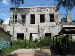
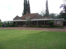
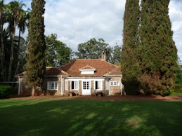
Steve and his partner live out west of Nairobi in an area called Karen which is where Karen Blixen had her farm early in the 1900s. Karen Blixen was the feature of the movie ‘Out of Africa’ with Meryl Streep and Robert Redford. By now, 80 years later, the farm has all been subdivided into ½ to 10 acre blocks. It is where a lot of the wealthier expats and locals live in Nairobi. The roads are quite good; all the houses are surrounded by big well trimmed hedges and fences. Steve’s house is about 300 m from her original house. The Blixen house has large well trimmed grounds, all of which has been turned into a museum now. The movie was filmed in this house. Some of the nostalgia of Karen’s time in Africa still remains in the neighbourhood; it is quiet, groomed with big trees. You can feel the past as you walk around the grounds imagining the nearby coffee farm, the elephants in the then bush running past the house and of taking tea with friends in the warm evening sun and looking up into the distant Ngong hills where she buried her friend Denys Finch Hatton after his plane crashed in Tsavo.
Etara
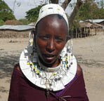
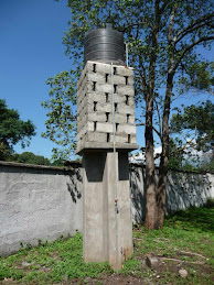
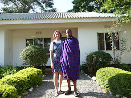
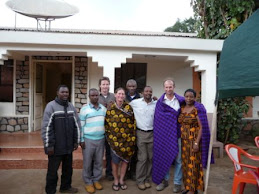
On the first day we were there, they took us to a local pre wedding ceremony. The groom to be was a Kikuyu (the main tribe about central Kenya and also the president is a Kikuyu as well). The bride to be is from Uganda. This ceremony is an old tradition where the bride and her relatives are invited over to the grooms house to meet the family and perform an Etara ritual. In the earlier days, after the wedding, the bride would take over all the house hold duties of the groom and that involved collecting firewood to cook on. They would store the firewood on a mantel above the fire so it would dry out faster. The mantel is called Etara in Kikuyu. The people now days get all dressed up in their finest to attend this ceremony. The Kenyan men were all in suits and the ladies in designer dresses. The Ugandan men were in a traditional skirt like wrap and the women were all dressed in traditional Ugandan dresses. Very colourful and impressive. Steve’s partner loaned us some clothes to get dressed up a bit. The ceremony was out the back of a big house in a marquee tent. Lots of food and drink. They had an MC to conduct the afternoon and several people gave speeches about what the commitment to a marriage means and not to be taken lightly. Some were serious and some quite funny. Quite a contrast to Tanzania. The higher degree of wealth is quite obvious.
Steve has an amazing range of stores to tell of what he has experienced in Africa, some quite potentially dangerous to him and other so absurd you have to laugh even though that stuff really goes on. He has learned so much in order to survive as a mzungu in an African country. Way more than we have ever seen and learned in our brief time here. One evening out by the BBQ he said the Kikuyu have a saying here, ‘when you get the dust of Africa on your shoes, it is hard to get off’
One morning he took us around the corner to a Giraffe center where people can hand feed the Giraffes. The people stand on a deck around a display room, up above the ground and wardens give out food pallets. These ever so elegant animals come over and slowly and gracefully eat the pallets out of your hand. Very cool.
The road from Arusha north to Nairobi is about 300 km (180 miles). The border is little town called Namunga. We drove our Pajero up there and in order to drive a vehicle across an international border there are a few rules to follow otherwise it won’t happen. As you approach Namunga there are no signs to tell you where to go or what to do. Turns out you have to go to Tanzania immigration to fill out a departure card, hand in the original vehicle registration card for the vehicle in another building, then go to Kenya immigration fill out a arrival card and get a visa, then in another building, sign your vehicle into Kenya. Not too bad really but with no signs or officials there, it is confusing. All the while there are merchandise vendors following you trying to sell you Maasai jewellery, international vehicle insurance, vehicle fire extinguishers and more. So anyway we got through after an hour and continued heading on to Nairobi.
The roads are currently very bad, with diversions in many places, but all along in both countries the roads are being worked on by road construction crews. So some time next year that road all the way from Arusha to Nairobi will be a beautiful sealed road and a pleasant drive. Our average speed was about 50 km/h (30 mph) for the 7 hours.
With texting our cousin Steve along the way we were able to meet him on the road before entering the CBD. We followed him out to his house out south West of Nairobi. We were there for a few days then took off on a 6 day hike to Mt Kenya then back to Steve’s again for a couple of more days then off to Uganda for 6 days to see the Gorillas in the jungle. Then back to his house for another day then headed back to Arusha in Tanzania.
Out of Africa
Steve and his partner live out west of Nairobi in an area called Karen which is where Karen Blixen had her farm early in the 1900s. Karen Blixen was the feature of the movie ‘Out of Africa’ with Meryl Streep and Robert Redford. By now, 80 years later, the farm has all been subdivided into ½ to 10 acre blocks. It is where a lot of the wealthier expats and locals live in Nairobi. The roads are quite good; all the houses are surrounded by big well trimmed hedges and fences. Steve’s house is about 300 m from her original house. The Blixen house has large well trimmed grounds, all of which has been turned into a museum now. The movie was filmed in this house. Some of the nostalgia of Karen’s time in Africa still remains in the neighbourhood; it is quiet, groomed with big trees. You can feel the past as you walk around the grounds imagining the nearby coffee farm, the elephants in the then bush running past the house and of taking tea with friends in the warm evening sun and looking up into the distant Ngong hills where she buried her friend Denys Finch Hatton after his plane crashed in Tsavo.
Etara
On the first day we were there, they took us to a local pre wedding ceremony. The groom to be was a Kikuyu (the main tribe about central Kenya and also the president is a Kikuyu as well). The bride to be is from Uganda. This ceremony is an old tradition where the bride and her relatives are invited over to the grooms house to meet the family and perform an Etara ritual. In the earlier days, after the wedding, the bride would take over all the house hold duties of the groom and that involved collecting firewood to cook on. They would store the firewood on a mantel above the fire so it would dry out faster. The mantel is called Etara in Kikuyu. The people now days get all dressed up in their finest to attend this ceremony. The Kenyan men were all in suits and the ladies in designer dresses. The Ugandan men were in a traditional skirt like wrap and the women were all dressed in traditional Ugandan dresses. Very colourful and impressive. Steve’s partner loaned us some clothes to get dressed up a bit. The ceremony was out the back of a big house in a marquee tent. Lots of food and drink. They had an MC to conduct the afternoon and several people gave speeches about what the commitment to a marriage means and not to be taken lightly. Some were serious and some quite funny. Quite a contrast to Tanzania. The higher degree of wealth is quite obvious.
Steve has an amazing range of stores to tell of what he has experienced in Africa, some quite potentially dangerous to him and other so absurd you have to laugh even though that stuff really goes on. He has learned so much in order to survive as a mzungu in an African country. Way more than we have ever seen and learned in our brief time here. One evening out by the BBQ he said the Kikuyu have a saying here, ‘when you get the dust of Africa on your shoes, it is hard to get off’
One morning he took us around the corner to a Giraffe center where people can hand feed the Giraffes. The people stand on a deck around a display room, up above the ground and wardens give out food pallets. These ever so elegant animals come over and slowly and gracefully eat the pallets out of your hand. Very cool.
Wednesday, July 7, 2010
Bye Bye Babati
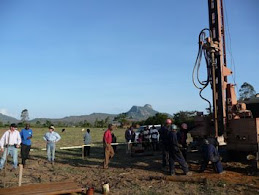
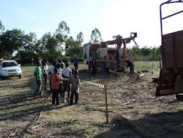
As we were coming to the end of June we needed to say goodbye to the people and the project in Babati. We had been there on and off since February working with the drillers to drill more water wells. However a series of delays by the rainy season, break downs of the drill rig and tooling, waiting on funds transfer for more fuel and the likes meant we had not been able achieve anywhere the progress we had wanted to gain by this date. We had other commitments already in place and so it was time to leave Babati. Not having reached our goal made it hard to leave though. It had seemed back in February that there had been plenty of time to finish the drilling, but these delays after delays had thrown a big wrench in any plans and expectations. The project local staff thanked us for our time there and graciously gave us parting gifts of a Kanga wrap for Ramona and a Maasai Shuka wrap for Ross. Even some of the staff at the little motel we had been staying at and whom we had gotten to know quite well, shed a few tears at our departure. It is hard to tell people you are leaving them and not coming back. They always say ‘Karibu tena’ which means ‘welcome back again’.
All throughout the Babati Project we had been working on and off with Darren of PCI USA who is the donor for the Babati project. He is the coordinator between PCI and the project. The locals had problems pronouncing his name and it came out like Darn, so that was the name he was stuck with in Babati. Darren was from the USA and used to live in Austin Texas as we did a few years ago. So we had a lot in common with him. We have become good friends and will miss working with him and his intelligent sense of humour that he never seemed to run out of. Darren is staying with the project till it is finished early next year and we wish him all the best with his work in years to come.
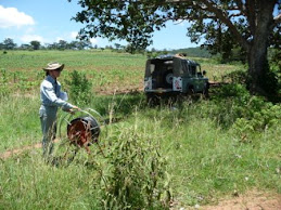
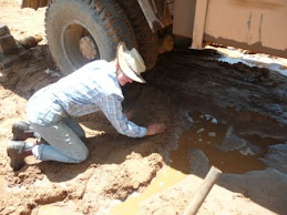
In one of the last days in Babati we drove to one of its outer sub villages to inspect 7 proposed drilling sites. These were all tucked up under the escarpment of part of the Great Rift. There must have been a thermal region not too deep underground at one of these places called Maji ya Moto (hot water) as here they showed us hot water coming out of the ground. The people said the villagers would come there every Friday to bath in the hot water. We never out found if that was mixed bathing or not. At another place there was a little mound that had steam coming from it. The top was quite spongy and would bounce up and down when jumped on. Hot mud could be seen in little vents. The local people said this mound was growing all the time so it appeared to be a very early stage Volcano we concluded! Let's see what it is in a 100 years!
All throughout the Babati Project we had been working on and off with Darren of PCI USA who is the donor for the Babati project. He is the coordinator between PCI and the project. The locals had problems pronouncing his name and it came out like Darn, so that was the name he was stuck with in Babati. Darren was from the USA and used to live in Austin Texas as we did a few years ago. So we had a lot in common with him. We have become good friends and will miss working with him and his intelligent sense of humour that he never seemed to run out of. Darren is staying with the project till it is finished early next year and we wish him all the best with his work in years to come.
In one of the last days in Babati we drove to one of its outer sub villages to inspect 7 proposed drilling sites. These were all tucked up under the escarpment of part of the Great Rift. There must have been a thermal region not too deep underground at one of these places called Maji ya Moto (hot water) as here they showed us hot water coming out of the ground. The people said the villagers would come there every Friday to bath in the hot water. We never out found if that was mixed bathing or not. At another place there was a little mound that had steam coming from it. The top was quite spongy and would bounce up and down when jumped on. Hot mud could be seen in little vents. The local people said this mound was growing all the time so it appeared to be a very early stage Volcano we concluded! Let's see what it is in a 100 years!
Mount Hanang Climb
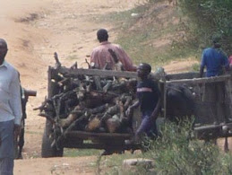
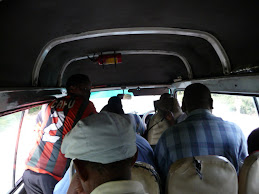
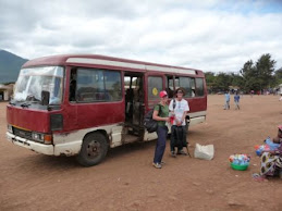
The drilling in Babati has been going slow with delays due to breakdowns, and waiting on getting refuelled. (There are multiday delays in getting funds transferred here). There are only so many days you can wait around in a little motel before you get an itch to do go do something else. We had seen this high mountain out west of Babati and had learned it was called Mount Hanang, the 4th highest mountain in Tanzania. It looked like a great mountain rising steeply and symmetrically out of the surrounding dry plains. The Lonely Planet book said there was a contact in Babati who would arrange climbs of the mountain. So we found his office and arranged to do the climb over the weekend. It was a 2-1/2 day trip, one day to travel to Katesh, the town at the base of Hanang and get the local government permits, the next day to climb and come down and the third day to return back to Babati. Another VSA volunteer Katherine working only a few hours from Babati joined us for the trip. The road from Babati to Katesh is a rough dirt/gravel dusty dusty road and requires slow driving in a small vehicle. Since it was not too far, 120 km (70 miles), we opted to take a bus there and back. How bad could it be? The climbing guide met us at the bus stand in Babati and had arranged the purchase of bus tickets for us all. It was an 11 am bus we were to catch, but turns out that 11 am means the bus will not leave before 11 am but can leave any time after that when it is full. They keep cramming more people with boxes and sacks of who knows what into spare seats and the isle. Finally at 12:30 we left for Katesh, filled to the hilt, many people standing in the isle and sitting in temporary seats. At about the ½ way point was another stop where people got on and off. The bus stopped on a little hill, and the attendant had to jump off the bus and put chocks under the wheels to stop the bus running backwards. Then onwards with dust wafting in covering any and everything.
After arriving at Katesh we were taken off for a small meal of rice and beans then to check into the guest house which while very basic was quite OK. At night the guide and a friend of his from Katesh took us to a little bar down the road to watch a World Cup soccer game on a TV. It was a little 14” like screen with a bunch of people seated around trying to watch it. Needless to say we were the only Mzungus there. The electric power was off in Katesh that night so there was no power. The TV was running off a little generator. After about 20 mins it ran out of fuel and that was the end of the TV, before the game even started! Then we decided to go get a meal somewhere before it got too late. The guide took us to this basic restaurant down this dark street as there were no lights. Inside the restaurant it was dark but they bought out a few candles. More rice and beans.
We started walking at 6 am the next day, it was a few km to the start of the mountain and then a gradual rise through some forests followed by steeper and steeper climbs the higher we got. The mountain is only 3400 (11,100 ft) high so there was foliage all the way up to the top. Lots of wild flowers out along the way. Being the end of the rainy season it was a good time to be there. It took us about 7 hours to get up to the top. The guides had bought up a packed lunch that we sat and ate while looking out over the plains far below. Quite an amazing site. The mountain is quite steep so once on top it is almost like looking out of an aeroplane. The plains were almost directly below us and stretched off into the distant horizon. We could see over to other places we had visited on earlier trips, the Ngorongoro crater game park, Lake Eyasi, and part of the Great Rift escarpment running North-South.
The trip down was about 5-6 hours, making a 14 hour day. We were trashed by the time we got back to Katesh, those last few km along the flat seemed to take ages. We sank wearily into seats at the same restaurant as the previous night and had more rice and beans and a bottle of Coke. It was all so good.
The bus trip back to Babati was similar to the one over. They just keep piling more and more people into them, trying to maximise the cash intake per trip much to the discomfort of the passengers. The attendant got into a brief tussle with one passenger over what we never knew and wanted to stay out of.
Friday, April 9, 2010
Visit to Victoria Falls, Zambia
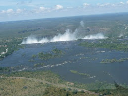
Over Easter, we took a long weekend and flew down to Livingstone in southern Zambia to visit the Victoria Falls. At 1.5 km wide and 100 m high, the falls are an impressive site at any time of the year. At this time of the year, it is rainy season and the falls were in full flow. There is normally white water rafting in the canyons below the falls, but with such a high flow rate, they had cancelled that activity.
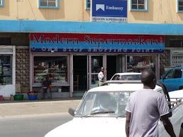
The falls are part in Zimbabwe and part in Zambia, but given the government forced decline in Zimbabwe, almost all tourists stay on the Zambian side nowadays. Zambia was a pleasant surprise, at least the small parts we saw of it. Good roads, almost every one speaks English, western clothes are common, and no power outages while we were there. Livingstone is quite the tourist area with many of the modern facilities run by South Africans. The town itself is somewhat dilapidated, but the road to the falls, 11 k away has many new hotels, shopping plazas, and restaurants catering to the more wealthy tourists. Livingston gets its name from Dr David Livingston the famous explorer back in the 1800s who bought news of Africa and its highlights to the then western world.
There are many activities set up for tourists to do and most hotels have an activities office which organise the bookings. The operators then come and pick you up from the hotel and drop you off afterwards if desired. The centre piece is of course the falls and all the different ways to see it. You can see the falls from pleasure boats from above the falls, you can fly over them in a helicopter or a microlight, walk down to the water’s edge where the water goes over the precipice. The best viewing is from the small park on the down stream side of the falls. The falls are part of the Zambezi river . The river is normally wide and gracefully flowing along. At the point of the falls however is a large deep fault that the water drops down into. From there the fault zigzags back and forth for many km downstream. All of the viewing anywhere is done from the top of the canyon, level with the top of the falls. Hence the downstream view of the falls is level with the top of the falls looking as the water falls down into the canyon. The flow rate is so high though (5 million lpm) that the thunder from the water is quite loud. There is a huge wall of mist rising out of the canyon that can be seen 30 km away. The local name for the falls translated means – the smoke that thunders. The mist rises up about 100 m above the falls then falls back to ground as rain. And rain it is! The little plateau, immediately downstream of the falls, is about 50 m from the water wall and where most of the viewing and pictures of the falls are taken. The falling mist just pelts down like a massive rain storm. No matter what you wear, you are going to get wet. Cameras and phones are going to get destroyed. Most tourists just walk in shorts and no shirt or a skimpy top, knowing they are going to get wet. One enterprising entrepreneur rents out rain jackets, but it is an exercise in futility as you are just going to get drenched. It is all quite fun to experience it. Then stand back 150 m from the falls and it is hot and dry.
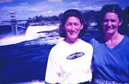
On Friday night we took a river boat ride up above the falls on the African Princess, a sister boat to the African Queen. A little more luxurious than the boat used by Audrey Hepburn and Humphrey Bogart! The Zambian side of the river is another park that stretches up river a ways. People can ride elephants in the park. That didn’t appeal to us however too much.
On Saturday morning we took a helicopter ride (Flight of the Angels) over and around the falls which was a great way to see the whole geology of the area and understand why they are like they are. You can see the big hotels that Zimbabwe used to offer but now are hardly used. After that we got taken to the falls park and a guide spent a couple of hours with us showing us along the paths and telling us about the falls and their history. Yep, he too got soaked to the bone. For lunch we went to the Royal Livingstone Hotel. It is on the Zambezi River waterfront right just back from the top of the falls. A magnificent view and beautiful grounds plus a deck over the water for drinking cocktails and watching the sunset on the other side of the Zambezi, with the roar of the falls a 100m away. The wait staff are immaculately dressed, the maitre-d wearing a tux and tails. The reception staff wear the old English pith exploring helmets. Very quaint. The meals are superb and the desserts are a work of art. There are a number of shops around this hotel and another nearby that sell high end souvenirs and house decorations with an African flavour. After lunch we went back to the park at the falls for some more watching. There is a bridge over the canyon just down from the falls. The east end is Zimbabwe and the west is Zambia. We walked out on the bridge to watch the bungee jumping and gorge swings off it into the canyon.
On Sunday we went with an operator, Abseil Zambia, to one of the canyons about 3 km downstream. They had set up a series of adrenaline activities like flying foxes, gorge swings, abseiling down the cliffs there. We signed up for a couple of goes on each of the activities. The abseiling was the most moderate. It was Ramona’s first time to do this but she did well. It was 2 min to go down and then 30 mins to walk back out of the canyon. Next was the flying fox. They strapped you into a harness attached to the middle of your back. At the top the strap was attached to a pulley. The pulley then runs on a cable stretched across the canyon. When swinging you are suspended like you are flying through the air. This had a 5 m long run to the cliff edge and then you leapt off into space. While running the strap is not tight so when you get to the edge and jump off you fall for about ½ m and during that time your heart is in your mouth. Dang! Once the strap comes tight and you realise it is not going to break and plummet you to the rocks below, you find yourself hanging horizontally and flying along the cable out over the canyon. It is quite cool. On the last time I took the video camera with me to capture the flying over the precipice out into the canyon.
Next came the Gorge Swing. After having seen it earlier that morning I was quite dreading it. This is no ordinary swing! Like the flying fox it is based on a main wire stretched over the canyon. Another cable is attached at one end to a pulley rolling on the main wire. The other end of this swing cable is attached to you via a harness. The scary thing is that the swing cable does not get tight until you have fallen down into the canyon 53m. Only then does it come tight and act like a swing and you swing back and forth over the canyon. So you start off on standing on this concrete platform sticking out over the gorge. Then you jump off and literally free fall these 53m which takes about 3.5 seconds. Then the swing cable snaps tight and you swing out into the canyon. Wow, does that 3.5 secs scare the heck out of you. You see the cliff face just rushing past you so fast and your mind tells you it is all over. It was just scary how fast you are falling before the cable comes tight and takes the weight. Ramona and I did it twice as a tandem strapped to each other at the hip. Me being heavier would fall faster and Ramona would get pulled over on top of me just as the swing cable came tight. Then once the cable was tight it was a nice swing back and forth over the canyon for a few minutes till they lowered us down to the valley floor. One of the assistants took our video camera and videoed us during the event. Not a movie to be shown in public. That is some scary activity, boy!
Monday had us flying back to Lusaka, the Zambian capital where we had a few hours to wait until our flight back to TZ. The taxi driver we had met on Friday was there to pick us up and take us to a shopping mall. We caught a good ol USA movie full of car chases and shoot outs, “Armored.” The taxi driver then took us back to the airport for a midnight flight back to Nairobi then Arusha.
The falls are part in Zimbabwe and part in Zambia, but given the government forced decline in Zimbabwe, almost all tourists stay on the Zambian side nowadays. Zambia was a pleasant surprise, at least the small parts we saw of it. Good roads, almost every one speaks English, western clothes are common, and no power outages while we were there. Livingstone is quite the tourist area with many of the modern facilities run by South Africans. The town itself is somewhat dilapidated, but the road to the falls, 11 k away has many new hotels, shopping plazas, and restaurants catering to the more wealthy tourists. Livingston gets its name from Dr David Livingston the famous explorer back in the 1800s who bought news of Africa and its highlights to the then western world.
There are many activities set up for tourists to do and most hotels have an activities office which organise the bookings. The operators then come and pick you up from the hotel and drop you off afterwards if desired. The centre piece is of course the falls and all the different ways to see it. You can see the falls from pleasure boats from above the falls, you can fly over them in a helicopter or a microlight, walk down to the water’s edge where the water goes over the precipice. The best viewing is from the small park on the down stream side of the falls. The falls are part of the Zambezi river . The river is normally wide and gracefully flowing along. At the point of the falls however is a large deep fault that the water drops down into. From there the fault zigzags back and forth for many km downstream. All of the viewing anywhere is done from the top of the canyon, level with the top of the falls. Hence the downstream view of the falls is level with the top of the falls looking as the water falls down into the canyon. The flow rate is so high though (5 million lpm) that the thunder from the water is quite loud. There is a huge wall of mist rising out of the canyon that can be seen 30 km away. The local name for the falls translated means – the smoke that thunders. The mist rises up about 100 m above the falls then falls back to ground as rain. And rain it is! The little plateau, immediately downstream of the falls, is about 50 m from the water wall and where most of the viewing and pictures of the falls are taken. The falling mist just pelts down like a massive rain storm. No matter what you wear, you are going to get wet. Cameras and phones are going to get destroyed. Most tourists just walk in shorts and no shirt or a skimpy top, knowing they are going to get wet. One enterprising entrepreneur rents out rain jackets, but it is an exercise in futility as you are just going to get drenched. It is all quite fun to experience it. Then stand back 150 m from the falls and it is hot and dry.
On Friday night we took a river boat ride up above the falls on the African Princess, a sister boat to the African Queen. A little more luxurious than the boat used by Audrey Hepburn and Humphrey Bogart! The Zambian side of the river is another park that stretches up river a ways. People can ride elephants in the park. That didn’t appeal to us however too much.
On Saturday morning we took a helicopter ride (Flight of the Angels) over and around the falls which was a great way to see the whole geology of the area and understand why they are like they are. You can see the big hotels that Zimbabwe used to offer but now are hardly used. After that we got taken to the falls park and a guide spent a couple of hours with us showing us along the paths and telling us about the falls and their history. Yep, he too got soaked to the bone. For lunch we went to the Royal Livingstone Hotel. It is on the Zambezi River waterfront right just back from the top of the falls. A magnificent view and beautiful grounds plus a deck over the water for drinking cocktails and watching the sunset on the other side of the Zambezi, with the roar of the falls a 100m away. The wait staff are immaculately dressed, the maitre-d wearing a tux and tails. The reception staff wear the old English pith exploring helmets. Very quaint. The meals are superb and the desserts are a work of art. There are a number of shops around this hotel and another nearby that sell high end souvenirs and house decorations with an African flavour. After lunch we went back to the park at the falls for some more watching. There is a bridge over the canyon just down from the falls. The east end is Zimbabwe and the west is Zambia. We walked out on the bridge to watch the bungee jumping and gorge swings off it into the canyon.
On Sunday we went with an operator, Abseil Zambia, to one of the canyons about 3 km downstream. They had set up a series of adrenaline activities like flying foxes, gorge swings, abseiling down the cliffs there. We signed up for a couple of goes on each of the activities. The abseiling was the most moderate. It was Ramona’s first time to do this but she did well. It was 2 min to go down and then 30 mins to walk back out of the canyon. Next was the flying fox. They strapped you into a harness attached to the middle of your back. At the top the strap was attached to a pulley. The pulley then runs on a cable stretched across the canyon. When swinging you are suspended like you are flying through the air. This had a 5 m long run to the cliff edge and then you leapt off into space. While running the strap is not tight so when you get to the edge and jump off you fall for about ½ m and during that time your heart is in your mouth. Dang! Once the strap comes tight and you realise it is not going to break and plummet you to the rocks below, you find yourself hanging horizontally and flying along the cable out over the canyon. It is quite cool. On the last time I took the video camera with me to capture the flying over the precipice out into the canyon.
Next came the Gorge Swing. After having seen it earlier that morning I was quite dreading it. This is no ordinary swing! Like the flying fox it is based on a main wire stretched over the canyon. Another cable is attached at one end to a pulley rolling on the main wire. The other end of this swing cable is attached to you via a harness. The scary thing is that the swing cable does not get tight until you have fallen down into the canyon 53m. Only then does it come tight and act like a swing and you swing back and forth over the canyon. So you start off on standing on this concrete platform sticking out over the gorge. Then you jump off and literally free fall these 53m which takes about 3.5 seconds. Then the swing cable snaps tight and you swing out into the canyon. Wow, does that 3.5 secs scare the heck out of you. You see the cliff face just rushing past you so fast and your mind tells you it is all over. It was just scary how fast you are falling before the cable comes tight and takes the weight. Ramona and I did it twice as a tandem strapped to each other at the hip. Me being heavier would fall faster and Ramona would get pulled over on top of me just as the swing cable came tight. Then once the cable was tight it was a nice swing back and forth over the canyon for a few minutes till they lowered us down to the valley floor. One of the assistants took our video camera and videoed us during the event. Not a movie to be shown in public. That is some scary activity, boy!
Monday had us flying back to Lusaka, the Zambian capital where we had a few hours to wait until our flight back to TZ. The taxi driver we had met on Friday was there to pick us up and take us to a shopping mall. We caught a good ol USA movie full of car chases and shoot outs, “Armored.” The taxi driver then took us back to the airport for a midnight flight back to Nairobi then Arusha.
Subscribe to:
Posts (Atom)


.JPG)


.JPG)


.JPG)